Geolocate

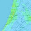
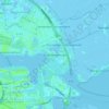
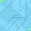
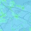
Heemstede topographic map

Click on the map to display elevation.

About this map

Name: Heemstede topographic map, elevation, terrain.

Location: Heemstede, North Holland, Netherlands (52.32220 4.59019 52.36340 4.64103)

Average elevation: 2 m

Minimum elevation: -6 m

Maximum elevation: 9 m

Other topographic maps

Click on a map to view its topography, its elevation and its terrain.

Catrijp

Netherlands > North Holland > Schoorl

Average elevation: 7 m

De Kooy

Netherlands > North Holland > Den Helder

Average elevation: 0 m

Anna's Berg

Netherlands > North Holland > Hilversum

Average elevation: 6 m

Zaan

Netherlands > North Holland > Zaandam

Average elevation: 2 m

Haarlem

Netherlands > North Holland > Haarlem

Average elevation: 0 m

Catrijper Nok

Netherlands > North Holland > Schoorl > Catrijp

Average elevation: 10 m

Spaarndam

Netherlands > North Holland

Average elevation: 0 m

Centrum

Netherlands > North Holland > Amsterdam

Average elevation: 7 m

Zuid-Haffel

Netherlands > North Holland > Den Burg

Average elevation: 0 m

Tafelberg

Netherlands > North Holland > Huizen

Average elevation: 15 m

Klet

Netherlands > North Holland > Broek op Langedijk

Average elevation: 0 m

Spang

Netherlands > North Holland > De Waal

Average elevation: -1 m

Hoofddorp

Netherlands > North Holland > Hoofddorp > Hoofddorp

Average elevation: -3 m

Strandslag 37

Netherlands > North Holland > Castricum

Average elevation: 4 m

Valkeveen

Netherlands > North Holland > Naarden

Average elevation: 2 m

Catrijp

Netherlands > North Holland > Schoorl

Average elevation: 7 m

Weesp

Netherlands > North Holland > Weesp

Average elevation: 0 m

Sloten

Netherlands > North Holland > Amsterdam

Average elevation: 0 m

Winterpark

Netherlands > North Holland > Nieuw-Vennep

Average elevation: -4 m

Gerbrandypark

Netherlands > North Holland > Amsterdam

Average elevation: 3 m

Friese Buurt

Netherlands > North Holland > Den Helder

Average elevation: 0 m

Bangert

Netherlands > North Holland > Andijk

Average elevation: -2 m

Valkeveen

Netherlands > North Holland > Naarden

Average elevation: 2 m

Gear up for your next adventure:

🧤Hiking Gloves - Protective gloves for outdoor use
🔭Compact Hiking Binoculars - Lightweight optics for scouting routes or birdwatching
🧼Biodegradable Outdoor Soap - Clean gear and yourself without harming the local ecosystem
🚴Cycling Backpacks - Backpacks for cyclists
🧊Insulated Stainless Steel Flasks - Keep water cold for 24 hours in the heat or coffee hot in the cold

As an Amazon Associate, this site earns from qualifying purchases at no extra cost to you.