Geolocate

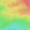
Chipman topographic map

Click on the map to display elevation.

About this map

Name: Chipman topographic map, elevation, terrain.

Location: Chipman, Chipman Parish, Municipality of Grand Lake, Queens County, New Brunswick, Canada (46.14311 -65.92265 46.19745 -65.84648)

Average elevation: 28 m

Minimum elevation: -1 m

Maximum elevation: 70 m

Other topographic maps

Click on a map to view its topography, its elevation and its terrain.
Gear up for your next adventure:

🖼️Scratch-off Australia Map - Track the regions and peaks you have explored geographically
🦯Adjustable Trekking Poles - Reduce impact on knees when descending steep topographic ridges
🧢Wide Brim Sun Hats - Maximum coverage for the face and neck while out in the open
💡Collapsible Camping Lanterns - Illuminate your base camp or tent for map studying at night
📣High-Decibel Survival Whistles - Signaling tool for rescue that carries much further than a human voice

As an Amazon Associate, this site earns from qualifying purchases at no extra cost to you.