Geolocate

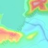
Moroshi topographic map

Click on the map to display elevation.

About this map

Name: Moroshi topographic map, elevation, terrain.

Location: Moroshi, Khed, Pune District, Maharashtra, India (18.99036 73.60043 19.03036 73.64043)

Average elevation: 781 m

Minimum elevation: 646 m

Maximum elevation: 904 m

Other topographic maps

Click on a map to view its topography, its elevation and its terrain.
Chaskaman

India > Maharashtra > Khed

Average elevation: 669 m

Gear up for your next adventure:

🛠️Outdoor Repair Kits - Gear repair kits
🎒Daypacks - Compact backpacks for short hikes
🧤Thermal Hiking Gloves - Keep your hands warm and functional during high-altitude winter treks
🥤Outdoor Water Bottles - Reusable bottles for outdoor activities
🦶Orthotic Hiking Insoles - Extra arch support for long-distance topographic treks

As an Amazon Associate, this site earns from qualifying purchases at no extra cost to you.