
Thank you for supporting this site ❤️
Make a donation
Make a donation
Gear up for your next adventure:
As an Amazon Associate, this site earns from qualifying purchases at no extra cost to you.
Haridwar topographic map
Click on the map to display elevation.
Thank you for supporting this site ❤️
Make a donation
Make a donation
Gear up for your next adventure:
As an Amazon Associate, this site earns from qualifying purchases at no extra cost to you.
About this map
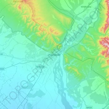
Name: Haridwar topographic map, elevation, terrain.
Location: Haridwar, Hardwar, Haridwar, Uttarakhand, 249401, India (29.77845 77.98530 30.09845 78.30530)
Average elevation: 360 m
Minimum elevation: 240 m
Maximum elevation: 1,093 m
Thank you for supporting this site ❤️
Make a donation
Make a donation
Gear up for your next adventure:
As an Amazon Associate, this site earns from qualifying purchases at no extra cost to you.