Geolocate

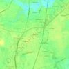
Farmville topographic map

Click on the map to display elevation.

About this map

Name: Farmville topographic map, elevation, terrain.

Location: Farmville, Pitt County, North Carolina, 27828, United States (35.56855 -77.63701 35.61902 -77.55554)

Average elevation: 24 m

Minimum elevation: 11 m

Maximum elevation: 31 m

Other topographic maps

Click on a map to view its topography, its elevation and its terrain.

Staton

United States > North Carolina > Pitt County

Average elevation: 12 m

Twin Creek

United States > North Carolina > Pitt County

Average elevation: 16 m

Stokes

United States > North Carolina > Pitt County

Average elevation: 15 m

Higgs

United States > North Carolina > Pitt County > Greenville

Average elevation: 15 m

Higgs

United States > North Carolina > Pitt County > Greenville

Average elevation: 15 m

Gear up for your next adventure:

🚴Bike GPS - GPS devices for cycling
🧭Global Orienteering Compass - High-precision liquid-filled compasses for accurate map reading and navigation
🎒3L Hydration Reservoirs - Hands-free drinking to stay hydrated on steep contour climbs
🥾Hiking Shoes - Lightweight hiking shoes for day hikes
🦟Insect Repellent - Protection against insects

As an Amazon Associate, this site earns from qualifying purchases at no extra cost to you.