
Thank you for supporting this site ❤️
Make a donation
Make a donation
Gear up for your next adventure:
As an Amazon Associate, this site earns from qualifying purchases at no extra cost to you.
Picoy topographic map
Click on the map to display elevation.
Thank you for supporting this site ❤️
Make a donation
Make a donation
Gear up for your next adventure:
As an Amazon Associate, this site earns from qualifying purchases at no extra cost to you.
About this map
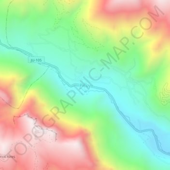
Name: Picoy topographic map, elevation, terrain.
Location: Picoy, Acobamba, Province of Tarma, Junín, Peru (-11.34518 -75.70949 -11.30518 -75.66949)
Average elevation: 3,454 m
Minimum elevation: 2,988 m
Maximum elevation: 4,096 m
Thank you for supporting this site ❤️
Make a donation
Make a donation
Gear up for your next adventure:
As an Amazon Associate, this site earns from qualifying purchases at no extra cost to you.