Geolocate

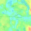
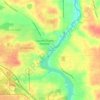
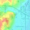
Caledonia topographic map

Click on the map to display elevation.

About this map

Name: Caledonia topographic map, elevation, terrain.

Location: Caledonia, Kent County, Michigan, United States (42.78269 -85.54545 42.80838 -85.50677)

Average elevation: 243 m

Minimum elevation: 228 m

Maximum elevation: 258 m

Other topographic maps

Click on a map to view its topography, its elevation and its terrain.
Harvard Lake

United States > Michigan > Kent County > Harvard

Average elevation: 267 m

Grattan

United States > Michigan > Kent County

Average elevation: 261 m

Ada

United States > Michigan > Kent County

Average elevation: 208 m

Kettle Lake

United States > Michigan > Kent County

Average elevation: 239 m

Cascade

United States > Michigan > Kent County

Average elevation: 222 m

Ada

United States > Michigan > Kent County

Average elevation: 208 m

Cobb Lake

United States > Michigan > Kent County > Bowne Township

Average elevation: 252 m

Grattan

United States > Michigan > Kent County > Grattan Township

Average elevation: 261 m

Parnell

United States > Michigan > Kent County > Grattan Township

Average elevation: 259 m

Gear up for your next adventure:

🚗Car Camping Gear - Equipment for vehicle camping
🍴Titanium Spork & Cutlery - Indestructible and feather-light eating utensils
🕶️Polarized Sunglasses - UV protection sunglasses for outdoors
🎒Tactical Waist Packs - Quick access to your compass, phone, and snacks while walking
👖Convertible Hiking Trousers - Zip-off legs to adapt to changing temperatures throughout the day

As an Amazon Associate, this site earns from qualifying purchases at no extra cost to you.