Geolocate

Recanto das Flores topographic map

Click on the map to display elevation.

About this map
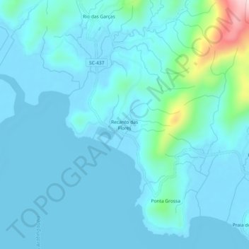
Name: Recanto das Flores topographic map, elevation, terrain.

Location: Recanto das Flores, Imaruí, Região Geográfica Imediata de Tubarão, Região Geográfica Intermediária de Criciúma, Santa Catarina, Região Sul, Brasil (-28.33561 -48.86771 -28.29561 -48.82771)

Average elevation: 36 m

Minimum elevation: -3 m

Maximum elevation: 325 m

Gear up for your next adventure:

🎒40L Day Hiking Backpacks - Comfortable packs with hydration support for long days exploring topographic peaks
⌚Altimeter Barometer Watches - Outdoor watches with built-in sensors to track altitude changes and weather shifts
📱Shockproof Phone Cases - Extra protection for your smartphone against drops on rocky terrain
🧭Military Style Lensatic Compass - Durable sighting compasses for advanced land navigation and surveying
🔥Windproof Plasma Lighters - USB rechargeable lighters that work in high-altitude winds

As an Amazon Associate, this site earns from qualifying purchases at no extra cost to you.