
Masquet topographic map
Interactive map
Click on the map to display elevation.
About this map
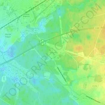
Name: Masquet topographic map, elevation, terrain.
Average elevation: 13 m
Minimum elevation: 2 m
Maximum elevation: 27 m
Other topographic maps
Click on a map to view its topography, its elevation and its terrain.
Castandet
France > Nouvelle-Aquitaine > Gironde > Mios
Castandet, Mios, Arcachon, Gironde, Nouvelle-Aquitaine, France métropolitaine, 33380, France
Average elevation: 17 m
Andron
France > Nouvelle-Aquitaine > Gironde > Mios
Andron, Mios, Arcachon, Gironde, Nouvelle-Aquitaine, France métropolitaine, 33380, France
Average elevation: 14 m