Geolocate

Cabantian topographic map

Click on the map to display elevation.

About this map

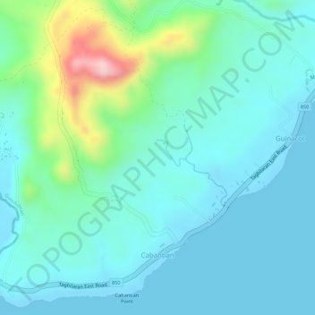
Name: Cabantian topographic map, elevation, terrain.

Location: Cabantian, Guindulman, Bohol, Central Visayas, Philippines (9.71995 124.42921 9.74558 124.45476)

Average elevation: 52 m

Minimum elevation: 0 m

Maximum elevation: 242 m

Other topographic maps

Click on a map to view its topography, its elevation and its terrain.

Bunhayag Nature Park

Philippines > Bohol > Guindulman > Canhaway

Average elevation: 77 m

Gear up for your next adventure:

🏫Topographic World Globes - 3D physical relief globes to understand global geography
🧼Biodegradable Outdoor Soap - Clean gear and yourself without harming the local ecosystem
📕Hiking Guide Books - Guides for hiking trails
🕶️Polarized Outdoor Sunglasses - Reduce glare from rocks and water for better visual navigation
🔦LED Torches - LED torches for outdoor use

As an Amazon Associate, this site earns from qualifying purchases at no extra cost to you.