
기장읍 topographic map
Interactive map
Click on the map to display elevation.
About this map
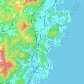
Name: 기장읍 topographic map, elevation, terrain.
Location: 기장읍, Gijang, Busan, Corea del Sur (35.18101 129.15666 35.26923 129.25348)
Average elevation: 78 m
Minimum elevation: 0 m
Maximum elevation: 460 m