
Lehenhof topographic map
Interactive map
Click on the map to display elevation.
About this map
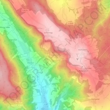
Name: Lehenhof topographic map, elevation, terrain.
Average elevation: 723 m
Minimum elevation: 542 m
Maximum elevation: 840 m
Other topographic maps
Click on a map to view its topography, its elevation and its terrain.
Oberhomberg
Deutschland > Baden-Württemberg > Bodenseekreis > Deggenhausertal
Oberhomberg, Deggenhausertal, Verwaltungsverband Markdorf, Bodenseekreis, Baden-Württemberg, 88693, Deutschland
Average elevation: 701 m