
Olso Lake topographic map
Interactive map
Click on the map to display elevation.
About this map
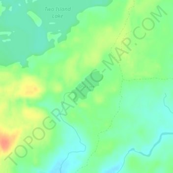
Name: Olso Lake topographic map, elevation, terrain.
Location: Olso Lake, West Cook, Cook County, Minnesota, United States (47.85966 -90.46020 47.86455 -90.45282)
Average elevation: 544 m
Minimum elevation: 528 m
Maximum elevation: 569 m