
Aarhus topographic map
Interactive map
Click on the map to display elevation.
About this map
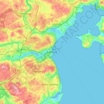
Name: Aarhus topographic map, elevation, terrain.
Location: Aarhus, Aarhus Kommune, Midden-Jutland, 8000, Denemarken (55.98963 10.05340 56.30963 10.37340)
Average elevation: 35 m
Minimum elevation: -4 m
Maximum elevation: 133 m