Geolocate

To topographic map

Click on the map to display elevation.

About this map

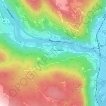
Name: To topographic map, elevation, terrain.

Location: To, Otta, Sel, Innlandet, 2670, Norway (61.74933 9.48086 61.78933 9.52086)

Average elevation: 583 m

Minimum elevation: 283 m

Maximum elevation: 1,066 m

Gear up for your next adventure:

🧥Thermal Emergency Blankets - Compact Mylar blankets to prevent hypothermia if stranded overnight
🚁Camera Drones with GPS - Capture aerial views of the landscape to compare with topo maps
🧼Clip-on Hand Sanitizer - Maintain hygiene when water for washing is scarce
🎒Ultralight Backpacks - Lightweight packs for long hikes
🛠️Outdoor Repair Kits - Gear repair kits

As an Amazon Associate, this site earns from qualifying purchases at no extra cost to you.