
Olhas topographic map
Interactive map
Click on the map to display elevation.
About this map
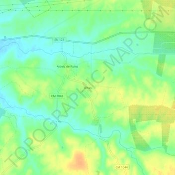
Name: Olhas topographic map, elevation, terrain.
Average elevation: 79 m
Minimum elevation: 64 m
Maximum elevation: 96 m
Other topographic maps
Click on a map to view its topography, its elevation and its terrain.
Odivelas
Portugal > Beja > Ferreira do Alentejo
Odivelas, Ferreira do Alentejo, Beja, Portugal
Average elevation: 88 m