
Chéhéry topographic map
Interactive map
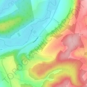
Click on the map to display elevation.
About this map
Name: Chéhéry topographic map, elevation, terrain.
Average elevation: 222 m
Minimum elevation: 149 m
Maximum elevation: 312 m
Other topographic maps
Click on a map to view its topography, its elevation and its terrain.
Chémery-sur-Bar
France > Grand Est > Ardennes > Chémery-Chéhéry
Chémery-sur-Bar, Chémery-Chéhéry, Sedan, Ardennes, Grand Est, France métropolitaine, France
Average elevation: 219 m