
Sikka topographic map
Interactive map
Click on the map to display elevation.
About this map
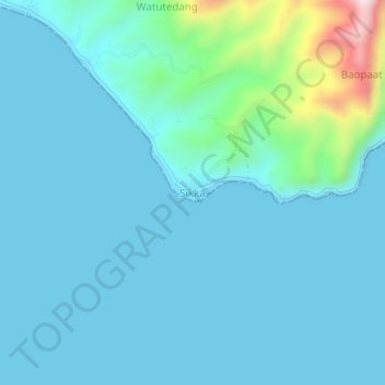
Name: Sikka topographic map, elevation, terrain.
Location: Sikka, Petites Îles de la Sonde orientales, Indonésie (-8.76938 122.17653 -8.72938 122.21653)
Average elevation: 60 m
Minimum elevation: 0 m
Maximum elevation: 485 m
Other topographic maps
Click on a map to view its topography, its elevation and its terrain.
Sikka
Indonésie > Petites Îles de la Sonde orientales > Sikka
Sikka, Petites Îles de la Sonde orientales, Indonésie
Average elevation: 154 m