
Orurillo topographic map
Interactive map
Click on the map to display elevation.
About this map
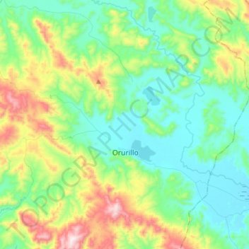
Name: Orurillo topographic map, elevation, terrain.
Location: Orurillo, Provincia de Melgar, Puno, Perú (-14.82492 -70.61646 -14.57457 -70.38181)
Average elevation: 4,097 m
Minimum elevation: 3,876 m
Maximum elevation: 4,734 m
Other topographic maps
Click on a map to view its topography, its elevation and its terrain.
Carmen Alto
Perú > Puno > Orurillo > Carmen Alto
Carmen Alto, Orurillo, Provincia de Melgar, Puno, Perú
Average elevation: 3,921 m