
Puy Chemin topographic map
Interactive map
Click on the map to display elevation.
About this map
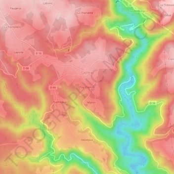
Name: Puy Chemin topographic map, elevation, terrain.
Average elevation: 471 m
Minimum elevation: 307 m
Maximum elevation: 557 m
Other topographic maps
Click on a map to view its topography, its elevation and its terrain.
Saumon
France > Nouvelle-Aquitaine > Corrèze > Lapleau
Saumon, Lapleau, Ussel, Corrèze, Nouvelle-Aquitaine, France métropolitaine, 19550, France
Average elevation: 467 m