
Lespartis topographic map
Interactive map
Click on the map to display elevation.
About this map
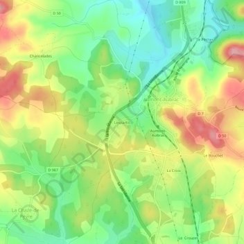
Name: Lespartis topographic map, elevation, terrain.
Average elevation: 1,047 m
Minimum elevation: 987 m
Maximum elevation: 1,123 m
Other topographic maps
Click on a map to view its topography, its elevation and its terrain.
La Croix
France > Occitanie > Lozère > Peyre en Aubrac > Aumont-Aubrac > La Croix
La Croix, Aumont-Aubrac, Peyre en Aubrac, Mende, Lozère, Occitanie, France métropolitaine, 48130, France
Average elevation: 1,051 m