
Thank you for supporting this site ❤️
Make a donation
Make a donation
Gear up for your next adventure:
As an Amazon Associate, this site earns from qualifying purchases at no extra cost to you.
Rabaul topographic map
Click on the map to display elevation.
Thank you for supporting this site ❤️
Make a donation
Make a donation
Gear up for your next adventure:
As an Amazon Associate, this site earns from qualifying purchases at no extra cost to you.
About this map
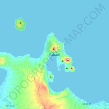
Name: Rabaul topographic map, elevation, terrain.
Location: Rabaul, East New Britain, Islands Region, Papua New Guinea (-4.35846 152.01283 -4.03846 152.33283)
Average elevation: 48 m
Minimum elevation: 0 m
Maximum elevation: 660 m
Thank you for supporting this site ❤️
Make a donation
Make a donation
Gear up for your next adventure:
As an Amazon Associate, this site earns from qualifying purchases at no extra cost to you.