
Fern Hill topographic map
Interactive map
Click on the map to display elevation.
About this map
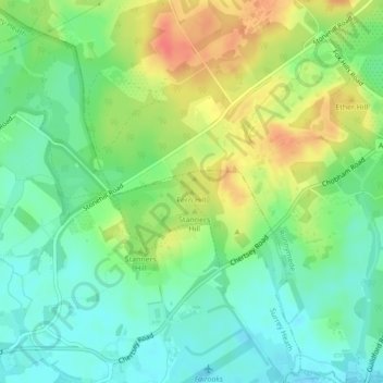
Name: Fern Hill topographic map, elevation, terrain.
Average elevation: 39 m
Minimum elevation: 18 m
Maximum elevation: 69 m
Other topographic maps
Click on a map to view its topography, its elevation and its terrain.
Camberley
United Kingdom > England > Surrey > Surrey Heath
Camberley, Surrey Heath, Surrey, England, GU15 3SD, United Kingdom
Average elevation: 88 m