
Porto Cesareo topographic map
Interactive map
Click on the map to display elevation.
About this map
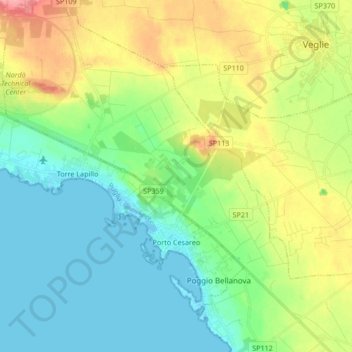
Name: Porto Cesareo topographic map, elevation, terrain.
Location: Porto Cesareo, Lecce, Apulia, Italy (40.23626 17.76246 40.33741 17.93084)
Average elevation: 31 m
Minimum elevation: -3 m
Maximum elevation: 93 m
Other topographic maps
Click on a map to view its topography, its elevation and its terrain.