Geolocate

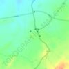
Sanva topographic map

Click on the map to display elevation.

About this map

Name: Sanva topographic map, elevation, terrain.

Location: Sanva, Rapar Taluka, Kachchh, Gujarat, 370155, India (23.58941 70.93744 23.62941 70.97744)

Average elevation: 27 m

Minimum elevation: 11 m

Maximum elevation: 43 m

Other topographic maps

Click on a map to view its topography, its elevation and its terrain.
Chitrod

India > Gujarat > Rapar Taluka

Average elevation: 110 m

Rapar

India > Gujarat > Rapar Taluka

Average elevation: 66 m

Gear up for your next adventure:

🎨Portable Watercolor Kits - Paint the landscapes and topographic views you discover
🔭Compact Hiking Binoculars - Lightweight optics for scouting routes or birdwatching
⌛Survival Blankets - Emergency thermal blankets
🖼️Scratch-off Australia Map - Track the regions and peaks you have explored geographically
📱Shockproof Phone Cases - Extra protection for your smartphone against drops on rocky terrain

As an Amazon Associate, this site earns from qualifying purchases at no extra cost to you.