
Blackcomb Glacier Provincial Park topographic map
Interactive map
Click on the map to display elevation.
About this map
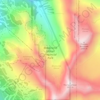
Name: Blackcomb Glacier Provincial Park topographic map, elevation, terrain.
Average elevation: 2,073 m
Minimum elevation: 1,616 m
Maximum elevation: 2,434 m
Other topographic maps
Click on a map to view its topography, its elevation and its terrain.
Whistler Village
Canada > British Columbia > Squamish-Lillooet Regional District > Whistler Resort Municipality
Whistler Village, Whistler Resort Municipality, Squamish-Lillooet Regional District, British Columbia, V8E 1M3, Canada
Average elevation: 775 m