Geolocate

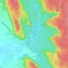
Sector 36 topographic map

Click on the map to display elevation.

About this map

Name: Sector 36 topographic map, elevation, terrain.

Location: Sector 36, Gurgaon, Haryana, India (28.41070 76.97901 28.43032 77.00037)

Average elevation: 222 m

Minimum elevation: 216 m

Maximum elevation: 229 m

Other topographic maps

Click on a map to view its topography, its elevation and its terrain.
Badshahpur

India > Haryana > Gurgaon

Average elevation: 228 m

Damdama Lake

India > Haryana > Gurgaon

Average elevation: 242 m

Gear up for your next adventure:

🦘Outback Survival Gear - Essential gear for Australian outback
🎒Hiking Backpacks - Backpacks designed for hiking and trekking
🕯️Emergency Whistles - Safety whistles for hiking
🧥Insulated Down Jackets - High warmth-to-weight ratio for cold nights in the high country
🎒3L Hydration Reservoirs - Hands-free drinking to stay hydrated on steep contour climbs

As an Amazon Associate, this site earns from qualifying purchases at no extra cost to you.