
Wéris topographic map
Interactive map
Click on the map to display elevation.
About this map
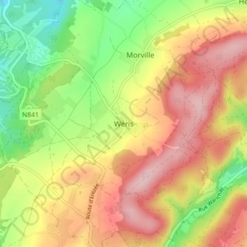
Name: Wéris topographic map, elevation, terrain.
Location: Wéris, Marche-en-Famenne, Luxembourg, Wallonie, 6941, Belgique (50.30664 5.51076 50.34664 5.55076)
Average elevation: 291 m
Minimum elevation: 183 m
Maximum elevation: 393 m