
Montsiá topographic map
Interactive map
Click on the map to display elevation.
About this map
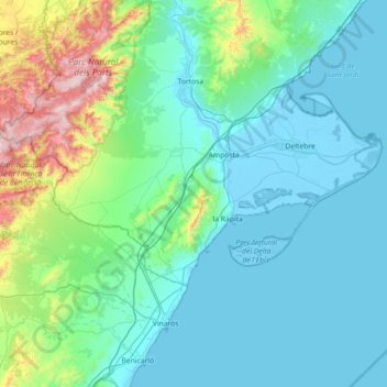
Name: Montsiá topographic map, elevation, terrain.
Location: Montsiá, Tarragona, Cataluña, España (40.52305 0.15941 40.78251 0.87659)
Average elevation: 205 m
Minimum elevation: -6 m
Maximum elevation: 1,397 m