Geolocate

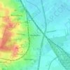
Tespe topographic map

Click on the map to display elevation.

About this map

Name: Tespe topographic map, elevation, terrain.

Location: Tespe, Samtgemeinde Elbmarsch, Harburg, Lower Saxony, 21395, Germany (53.35513 10.36304 53.41150 10.47137)

Average elevation: 13 m

Minimum elevation: 1 m

Maximum elevation: 72 m

Other topographic maps

Click on a map to view its topography, its elevation and its terrain.
Elstorf

Germany > Lower Saxony > Harburg > Neu Wulmstorf

Average elevation: 53 m

Meckelfeld

Germany > Lower Saxony > Harburg > Seevetal

Average elevation: 17 m

Langenrehm

Germany > Lower Saxony > Harburg

Average elevation: 115 m

Gear up for your next adventure:

🔪Outdoor Multi-tools - Versatile tools for gear repair and survival tasks in the wilderness
🔪Camping Knives - Multi-purpose outdoor knives
🛠️Outdoor Repair Kits - Gear repair kits
📱Shockproof Phone Cases - Extra protection for your smartphone against drops on rocky terrain
🎒Hiking Backpacks - Backpacks designed for hiking and trekking

As an Amazon Associate, this site earns from qualifying purchases at no extra cost to you.