
Athus topographic map
Interactive map
Click on the map to display elevation.
About this map
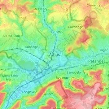
Name: Athus topographic map, elevation, terrain.
Location: Athus, Aubange, Arlon, Luxembourg, Wallonie, 6791, Belgio (49.52155 5.79069 49.60155 5.87069)
Average elevation: 318 m
Minimum elevation: 258 m
Maximum elevation: 422 m