
Bernardi topographic map
Interactive map
Click on the map to display elevation.
About this map
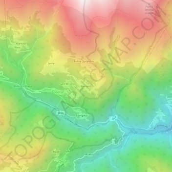
Name: Bernardi topographic map, elevation, terrain.
Location: Bernardi, Ostana, Coni, Piémont, Italie (44.67376 7.17762 44.71376 7.21762)
Average elevation: 1,408 m
Minimum elevation: 770 m
Maximum elevation: 2,171 m
Other topographic maps
Click on a map to view its topography, its elevation and its terrain.