
Carhuamarca topographic map
Interactive map
Click on the map to display elevation.
About this map
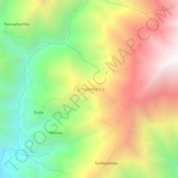
Name: Carhuamarca topographic map, elevation, terrain.
Location: Carhuamarca, Cáceres del Perú, Santa, Áncash, Perú (-8.95256 -78.08360 -8.91256 -78.04360)
Average elevation: 3,006 m
Minimum elevation: 2,033 m
Maximum elevation: 4,080 m
Other topographic maps
Click on a map to view its topography, its elevation and its terrain.
Cáceres del Perú
Perú > Áncash > Cáceres del Perú
Cáceres del Perú, Santa, Áncash, Perú
Average elevation: 2,954 m