
Thank you for supporting this site ❤️
Make a donation
Make a donation
Gear up for your next adventure:
As an Amazon Associate, this site earns from qualifying purchases at no extra cost to you.
Messaad topographic map
Click on the map to display elevation.
Thank you for supporting this site ❤️
Make a donation
Make a donation
Gear up for your next adventure:
As an Amazon Associate, this site earns from qualifying purchases at no extra cost to you.
About this map
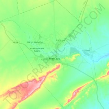
Name: Messaad topographic map, elevation, terrain.
Location: Messaad, Messâad District, Djelfa, 17400, Algeria (34.07975 3.39659 34.24018 3.56748)
Average elevation: 803 m
Minimum elevation: 718 m
Maximum elevation: 1,015 m
Thank you for supporting this site ❤️
Make a donation
Make a donation
Gear up for your next adventure:
As an Amazon Associate, this site earns from qualifying purchases at no extra cost to you.