
Town of Moira topographic map
Interactive map
Click on the map to display elevation.
About this map
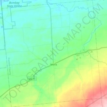
Name: Town of Moira topographic map, elevation, terrain.
Location: Town of Moira, Franklin County, New York, United States (44.77455 -74.63117 44.88415 -74.48676)
Average elevation: 125 m
Minimum elevation: 77 m
Maximum elevation: 266 m
Other topographic maps
Click on a map to view its topography, its elevation and its terrain.
Malone Junction
United States > New York > Franklin County > Malone > Malone Junction
Malone Junction, Malone, Franklin County, New York, 12953, United States
Average elevation: 233 m