
Zandhuizen topographic map
Interactive map
Click on the map to display elevation.
About this map
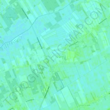
Name: Zandhuizen topographic map, elevation, terrain.
Location: Zandhuizen, Weststellingwerf, Friesland, Niederlande (52.89844 6.12630 52.93345 6.17931)
Average elevation: 4 m
Minimum elevation: 0 m
Maximum elevation: 8 m
Other topographic maps
Click on a map to view its topography, its elevation and its terrain.
Nijeholtwolde
Niederlande > Friesland > Weststellingwerf
Nijeholtwolde, Weststellingwerf, Friesland, Niederlande
Average elevation: 0 m
De Blesse
Niederlande > Friesland > Weststellingwerf
De Blesse, Weststellingwerf, Friesland, Niederlande
Average elevation: 3 m
Boijl
Niederlande > Friesland > Weststellingwerf
Boijl, Weststellingwerf, Friesland, Niederlande
Average elevation: 6 m
Langelille
Niederlande > Friesland > Weststellingwerf
Langelille, Weststellingwerf, Friesland, Niederlande
Average elevation: 0 m
Peperga
Niederlande > Friesland > Weststellingwerf
Peperga, Weststellingwerf, Friesland, Niederlande
Average elevation: 2 m
Munnekeburen
Niederlande > Friesland > Weststellingwerf
Munnekeburen, Weststellingwerf, Friesland, Niederlande
Average elevation: 0 m
Oldeholtwolde
Niederlande > Friesland > Weststellingwerf
Oldeholtwolde, Weststellingwerf, Friesland, Niederlande
Average elevation: 0 m
Oldelamer
Niederlande > Friesland > Weststellingwerf
Oldelamer, Weststellingwerf, Friesland, Niederlande
Average elevation: 0 m
Ter Idzard
Niederlande > Friesland > Weststellingwerf
Ter Idzard, Weststellingwerf, Friesland, Niederlande
Average elevation: 1 m
Noordwolde
Niederlande > Friesland > Weststellingwerf
Noordwolde, Weststellingwerf, Friesland, Niederlande
Average elevation: 3 m
Oldetrijne
Niederlande > Friesland > Weststellingwerf
Oldetrijne, Weststellingwerf, Friesland, Niederlande
Average elevation: 0 m
Nijetrijne
Niederlande > Friesland > Weststellingwerf
Nijetrijne, Weststellingwerf, Friesland, Niederlande
Average elevation: 0 m
Steggerda
Niederlande > Friesland > Weststellingwerf
Steggerda, Weststellingwerf, Friesland, Niederlande
Average elevation: 2 m
Oosterstreek
Niederlande > Friesland > Weststellingwerf
Oosterstreek, Weststellingwerf, Friesland, Niederlande
Average elevation: 4 m
Blesdijke
Niederlande > Friesland > Weststellingwerf
Blesdijke, Weststellingwerf, Friesland, Niederlande
Average elevation: 3 m