
Norbo Finnmark topographic map
Interactive map
Click on the map to display elevation.
About this map
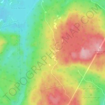
Name: Norbo Finnmark topographic map, elevation, terrain.
Location: Norbo Finnmark, Säters kommun, Comté de Dalécarlie, Suède (60.26112 15.43329 60.30112 15.47329)
Average elevation: 247 m
Minimum elevation: 176 m
Maximum elevation: 335 m