
Forsmark topographic map
Interactive map
Click on the map to display elevation.
About this map
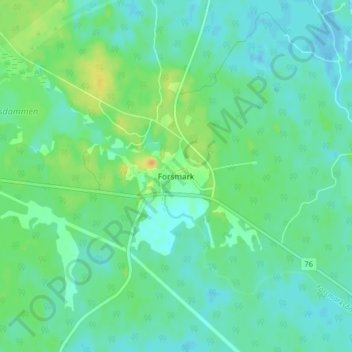
Name: Forsmark topographic map, elevation, terrain.
Location: Forsmark, Östhammars kommun, Uppsala län, Zweden (60.35089 18.13559 60.39089 18.17559)
Average elevation: 9 m
Minimum elevation: -9 m
Maximum elevation: 29 m
Other topographic maps
Click on a map to view its topography, its elevation and its terrain.
Vittinge
Vittinge, Heby kommun, Uppsala län, 744 95, Zweden
Average elevation: 66 m