
De Gest topographic map
Interactive map
Click on the map to display elevation.
About this map
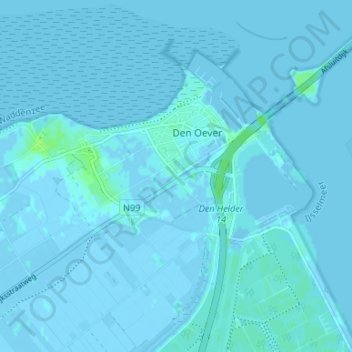
Name: De Gest topographic map, elevation, terrain.
Average elevation: 0 m
Minimum elevation: -5 m
Maximum elevation: 10 m
Other topographic maps
Click on a map to view its topography, its elevation and its terrain.
Oosterland
Nederland > Noord-Holland > Den Oever
Oosterland, Den Oever, Hollands Kroon, Noord-Holland, Nederland, 1779 GG, Nederland
Average elevation: 0 m