
Île d'Yvoir topographic map
Interactive map
Click on the map to display elevation.
About this map
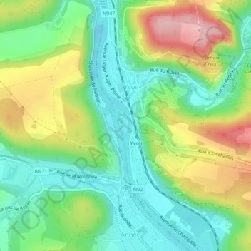
Name: Île d'Yvoir topographic map, elevation, terrain.
Location: Île d'Yvoir, Yvoir, Dinant, Namur, Wallonie, Belgique (50.32110 4.87617 50.32268 4.87718)
Average elevation: 143 m
Minimum elevation: 78 m
Maximum elevation: 254 m
Other topographic maps
Click on a map to view its topography, its elevation and its terrain.