
Moulin à Vent topographic map
Interactive map
Click on the map to display elevation.
About this map
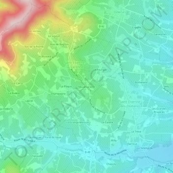
Name: Moulin à Vent topographic map, elevation, terrain.
Average elevation: 318 m
Minimum elevation: 220 m
Maximum elevation: 610 m
Other topographic maps
Click on a map to view its topography, its elevation and its terrain.
Mas de Bagnols
France > Auvergne-Rhône-Alpes > Rhône > Saint-Étienne-la-Varenne
Mas de Bagnols, Saint-Étienne-la-Varenne, Villefranche-sur-Saône, Rhône, Circonscription départementale du Rhône, Auvergne-Rhône-Alpes, France métropolitaine, 69460, France
Average elevation: 375 m