
Thank you for supporting this site ❤️
Make a donation
Make a donation
Gear up for your next adventure:
As an Amazon Associate, this site earns from qualifying purchases at no extra cost to you.
Bispgården topographic map
Click on the map to display elevation.
Thank you for supporting this site ❤️
Make a donation
Make a donation
Gear up for your next adventure:
As an Amazon Associate, this site earns from qualifying purchases at no extra cost to you.
About this map
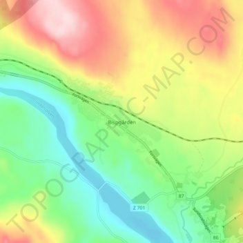
Name: Bispgården topographic map, elevation, terrain.
Location: Bispgården, Ragunda kommun, Jämtland County, 840 73, Sweden (63.00415 16.61549 63.04415 16.65549)
Average elevation: 190 m
Minimum elevation: 82 m
Maximum elevation: 343 m
Thank you for supporting this site ❤️
Make a donation
Make a donation
Gear up for your next adventure:
As an Amazon Associate, this site earns from qualifying purchases at no extra cost to you.