
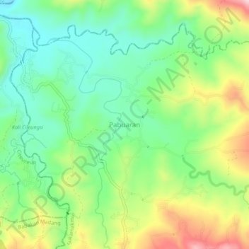
Pabuaran topographic map
Click on the map to display elevation.
About this map
Name: Pabuaran topographic map, elevation, terrain.
Average elevation: 260 m
Minimum elevation: 159 m
Maximum elevation: 434 m
Other topographic maps
Click on a map to view its topography, its elevation and its terrain.
Cisarua
Cisarua is a location and district in the Bogor Regency, located in the province of West Java, with a population of 127,096 in 2020.[1] The district is known for its mild climate, tea fields, and extensive views, being located in a rather high altitude.[citation needed]
Average elevation: 1,310 m