
El Trebol topographic map
Interactive map
Click on the map to display elevation.
About this map
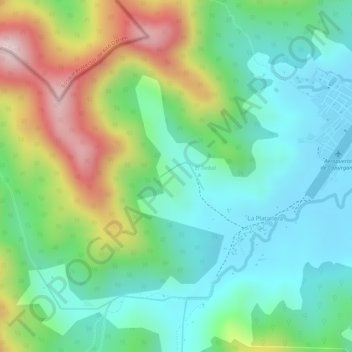
Name: El Trebol topographic map, elevation, terrain.
Location: El Trebol, Acandí, Chocó, 278017, Colombia (8.62958 -77.36427 8.63173 -77.36053)
Average elevation: 132 m
Minimum elevation: 7 m
Maximum elevation: 366 m
Other topographic maps
Click on a map to view its topography, its elevation and its terrain.
Bahía Solano
Colombia > Chocó > Bahía Solano
Bahía Solano, Bahía Solano (Mutis), Chocó, Colombia
Average elevation: 128 m