
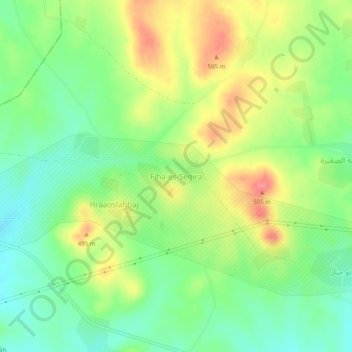
Fiha-es-Segira topographic map
Interactive map
Click on the map to display elevation.
About this map
Name: Fiha-es-Segira topographic map, elevation, terrain.
Location: Fiha-es-Segira, ناحية تادف, منطقة الباب, محافظة حلب, Syrië (36.32597 37.58496 36.36597 37.62496)
Average elevation: 475 m
Minimum elevation: 443 m
Maximum elevation: 516 m