
Zillertal topographic map
Interactive map
Click on the map to display elevation.
About this map
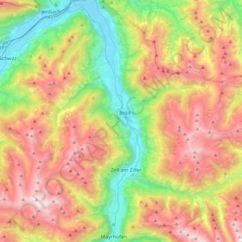
Name: Zillertal topographic map, elevation, terrain.
Location: Zillertal, Kaltenbach, Bezirk Schwaz, Tirol, Österreich (47.16204 11.82069 47.40245 11.89802)
Average elevation: 1,499 m
Minimum elevation: 520 m
Maximum elevation: 2,736 m
Das Zillertal ist über die Zillertalstraße (B 169), die Anschluss an die Inntalautobahn bietet, erschlossen. Bei Zell am Ziller zweigt die Gerlosstraße (B 165) ab, die über den Gerlospass eine Verbindung ins Oberpinzgau darstellt. Die Zillertaler Höhenstraße ist eine kurvenreiche, mautpflichtige Aussichtsstraße; weitere Mautstraßen führen im Sommer ins Zillergründl und zum Schlegeisspeicher.