
Kabaena topographic map
Interactive map
Click on the map to display elevation.
About this map
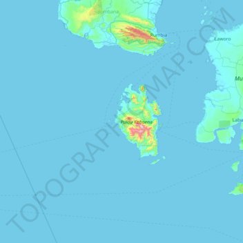
Name: Kabaena topographic map, elevation, terrain.
Location: Kabaena, Southeast Sulawesi, Sulawesi, 93781, Indonesia (-5.97458 121.13738 -4.57458 122.53738)
Average elevation: 24 m
Minimum elevation: -1 m
Maximum elevation: 1,499 m
Other topographic maps
Click on a map to view its topography, its elevation and its terrain.