
Emerald Isle topographic map
Click on the map to display elevation.
About this map
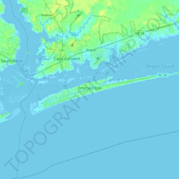
Name: Emerald Isle topographic map, elevation, terrain.
Average elevation: 2 m
Minimum elevation: -3 m
Maximum elevation: 17 m
Other topographic maps
Click on a map to view its topography, its elevation and its terrain.
Mitchell Village
United States > North Carolina > Carteret County > Morehead City
Average elevation: 3 m
Sound of the Sea
United States > North Carolina > Carteret County > Emerald Isle
Average elevation: 1 m
Spooners Creek East Harbor
United States > North Carolina > Carteret County > Morehead City
Average elevation: 3 m