
Galunggung topographic map
Interactive map
Click on the map to display elevation.
About this map
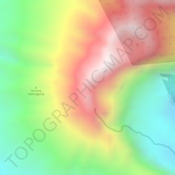
Name: Galunggung topographic map, elevation, terrain.
Location: Galunggung, Tasikmalaya, West-Java, Indonesien (-7.25005 108.05795 -7.24995 108.05805)
Average elevation: 1,636 m
Minimum elevation: 1,139 m
Maximum elevation: 2,135 m