Geolocate

Caistor topographic map

Click on the map to display elevation.

About this map
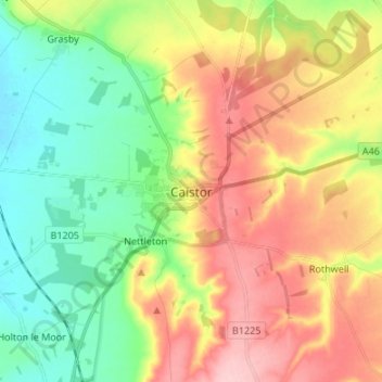
Name: Caistor topographic map, elevation, terrain.

Location: Caistor, West Lindsey, Lincolnshire, England, LN7 6TJ, United Kingdom (53.45689 -0.35538 53.53689 -0.27538)

Average elevation: 79 m

Minimum elevation: 13 m

Maximum elevation: 166 m

Other topographic maps

Click on a map to view its topography, its elevation and its terrain.

Tealby

United Kingdom > England > Lincolnshire > West Lindsey > Tealby

Average elevation: 73 m

Gear up for your next adventure:

🎨Portable Watercolor Kits - Paint the landscapes and topographic views you discover
🏃Compression Recovery Socks - Reduce leg fatigue after heavy days of elevation gain
🦟Insect Repellent - Protection against insects
🎒Dry Bags - Waterproof bags for outdoor gear
🎽Base Layers - Thermal base layers

As an Amazon Associate, this site earns from qualifying purchases at no extra cost to you.